سوالات نقشه برداری

الدین اسد آبادی با همکاری انجمنهای علمی نقشهبرداری دانشگاه های خواجه نصیر ،بجنورد، نوشیروانی ،اصفهان
و تفرش راهاندازی شده است.
ارتباط با ادمین:
@i_amir_mafi
لینک کانال :
@surveyors_sjau

?? ??? ?? ????? ?
We comply with Telegram's guidelines:
- No financial advice or scams
- Ethical and legal content only
- Respectful community
Join us for market updates, airdrops, and crypto education!
Last updated 10 months, 1 week ago

[ We are not the first, we try to be the best ]
Last updated 1 year ago

FAST MTPROTO PROXIES FOR TELEGRAM
ads : @IR_proxi_sale
Last updated 8 months, 3 weeks ago
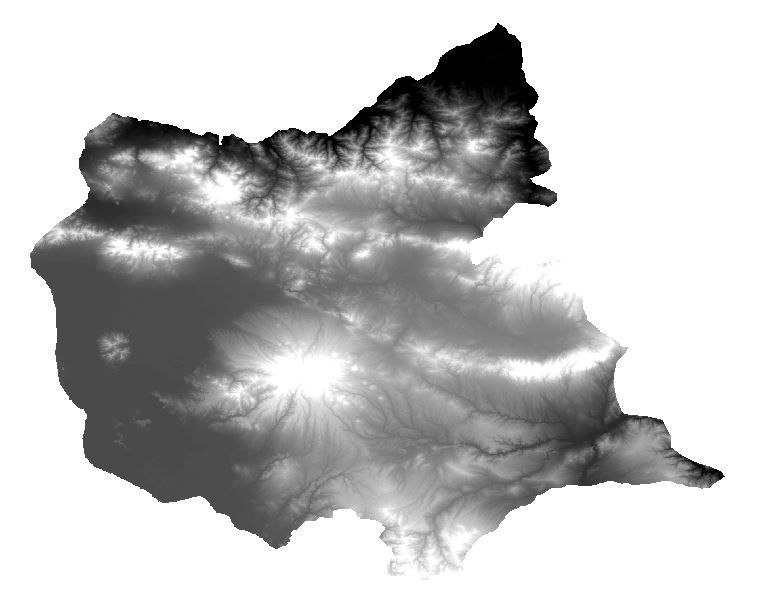
مدل دیجیتالی ارتفاع (DEM) یک نمایش سه بعدی از سطح زمین است که ارتفاع هر نقطه را نشان می دهد. DEM ها از منابع مختلف داده های ارتفاعی مانند نقشه های توپوگرافی، تصاویر ماهواره ای، عکس های هوایی، لیدار، رادار و اندازه گیری های میدانی ایجاد می شوند. DEM ها به طور گسترده در بسیاری از کاربردها مانند نقشه برداری، نقشه برداری، مهندسی، زمین شناسی، هیدرولوژی، اکولوژی، کشاورزی، مدیریت بلایا و غیره استفاده می شوند.
آموزش ساخت DEM در ArcGISبه زبان ساده در لینک زیر:
https://b2n.ir/k63972
پاسخ صحیح:گزینه۱
پاسخ صحیح:گزینه۳
پاسخ صحیح:گزینه۱
?? ??? ?? ????? ?
We comply with Telegram's guidelines:
- No financial advice or scams
- Ethical and legal content only
- Respectful community
Join us for market updates, airdrops, and crypto education!
Last updated 10 months, 1 week ago
[ We are not the first, we try to be the best ]
Last updated 1 year ago
FAST MTPROTO PROXIES FOR TELEGRAM
ads : @IR_proxi_sale
Last updated 8 months, 3 weeks ago